Popular PC Components in Russia Highlight Nvidia RTX 50 Series and 1TB NVMe SSDs
July 21, 2026
A new approach employing drones outfitted with ground-penetrating radar (GPR) aims to advance the search for water ice on Mars by enabling spacecraft to identify optimal drilling locations. A research team from the University of Arizona, led by Roberto Aguilar, demonstrated the effectiveness of this technology by accurately mapping buried glaciers in Alaska and Wyoming—terrestrial analogs to the subsurface ice deposits found on the Red Planet.
The challenge of locating accessible water ice beneath the surface is a critical hurdle for Mars missions focused on long-term exploration and eventual colonization. Subsurface ice not only offers a potential water source for astronauts but also provides key scientific insights into Mars’ climate history.
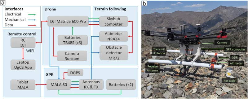
To refine methods for identifying these icy reservoirs before drilling, the University of Arizona team turned to Earth’s own ice-rich environments that closely resemble Martian subsurface conditions. By deploying drones equipped with GPR to Alaska and Wyoming, the researchers were able to create detailed geological maps of ice layers buried underground. This method allows for enhanced precision in detecting subsurface ice formations compared to conventional satellite or rover-based observations.
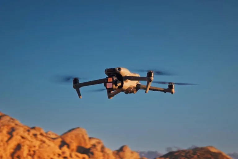
The drones, capable of flying low and scanning large areas, provide a versatile platform for gathering high-resolution data without the constraints typically faced by ground vehicles. Their radar systems can penetrate soil and ice layers to reveal the structure and depth of hidden glaciers, providing valuable analog data to improve the interpretation of radar signals expected on Mars.
Such improved geospatial understanding will directly inform the selection of drilling sites on Mars, helping future missions avoid unnecessary excavation and increasing the odds of accessing viable water ice. This capability is particularly significant for robotic missions tasked with in-situ resource utilization (ISRU), where accessing local water reserves could sustain human habitats and fuel production.
The successful application of ground-penetrating radar on drones in Earth’s ice fields is a promising step toward adapting this technology for Martian exploration. It exemplifies how leveraging terrestrial analogs can help prepare for the logistical and scientific complexities of operating in extraterrestrial environments.
While the research does not specify when this technology will be deployed on Mars, its terrestrial validation underscores its potential role in forthcoming missions targeting water ice discovery and extraction on the planet.
University of Arizona researchers use radar drones to map buried ice on Earth, improving Mars water search and drilling site selection.